
Weekly revenue
Available on Pro
Weekly downloads
Available on Pro
Rating
—
Price
$4.99
Subscribers only
Subscribe to see revenue estimates, ads, complaints and keywords.
Launch offer: 50% off until October 31, 2026
Weekly revenue
Weekly downloads
Rating
Price
Subscribe to see revenue estimates, ads, complaints and keywords.
Launch offer: 50% off until October 31, 2026
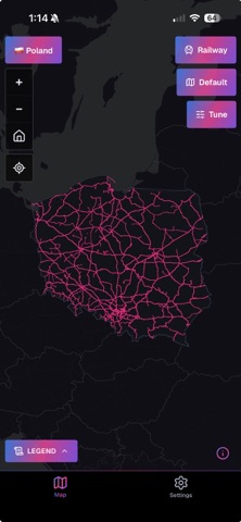

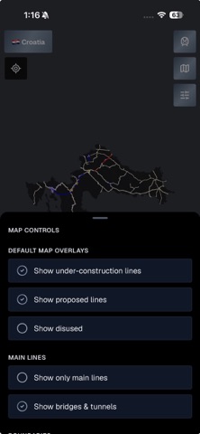


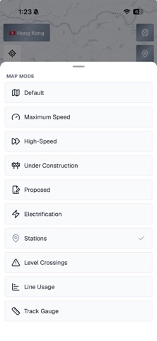
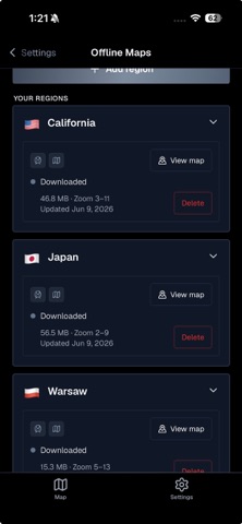
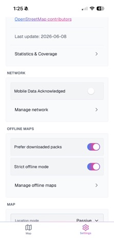
See how the rail network is built. RailsMaps maps railway, metro and tram lines in 1,150+ regions (countries, states, provinces, cities): max speeds, lines under construction, proposed routes, disused and abandoned lines, stations, level crossings, bridges and tunnels, electrification and track gauge. It's an infrastructure map, not a journey planner. Pick a region and you get every line, from national main lines to city trams, downloadable for offline use. One-time purchase. No subscription, no ads. INFRASTRUCTURE MAP MODES • Max speed: lines colored by permitted speed • Electrification: electrified lines by system and voltage (AC and DC) • Track gauge: standard, broad, narrow and mixed • Usage: main lines, branch lines, industrial, heritage and military • High-speed: dedicated high-speed lines and upgraded fast corridors • Stations and halts • Level crossings, classified by safety level • Under construction: lines and extensions being built • Proposed: planned and approved future lines • Historical: disused and abandoned railways Available map modes depend on the region and rail type. EVERY RAIL TYPE • Mainline railways, metro (subway / underground), tram, light rail, narrow gauge, monorail, funicular and miniature railways TAP FOR DETAILS • Tap any line or station for speed, gauge, electrification, usage and Wikipedia info WORKS OFFLINE • Download a region once, then use it with no connection • Offline packs are updated weekly • Detail scales with region size: city packs zoom in further than country packs, and you see the zoom range before you download • Strict offline mode: the app uses only your downloaded packs and makes no network requests • Wi-Fi-only downloads and per-region storage control MAKE IT YOURS • Built-in presets: Default and FreakMaps (infrastructure-style colors) • Custom presets: set rail line colors, widths and opacity • Save up to 20 presets, with separate colors for light and dark maps • Light, dark or auto basemap, plus an OpenStreetMap-style Carto look • Adjustable rail opacity, map labels on or off • Country and city boundary overlays • Compare two regions side by side • App theme: light, dark or system SEE WHERE YOU ARE (OPTIONAL) • Show your position on the rail network, in passive or active location mode • In active mode the map follows you along the line, handy on heritage railways and old routes BONUS: 2 WEEKS OF WEB EXPORT Buying the app includes a free 2-week map export pass for railsmaps.com and freakmaps.com. Style a map, clip it to a region and download it as a watermark-free PNG, right in your browser. One-time claim. COVERAGE • 1,150+ regions: countries, states, provinces and major cities • 13 interface languages Map data © OpenStreetMap contributors. Detail and completeness vary by region. Same data as railsmaps.com, the free web map, now on your phone.
US App Store, Oct 7, 2026